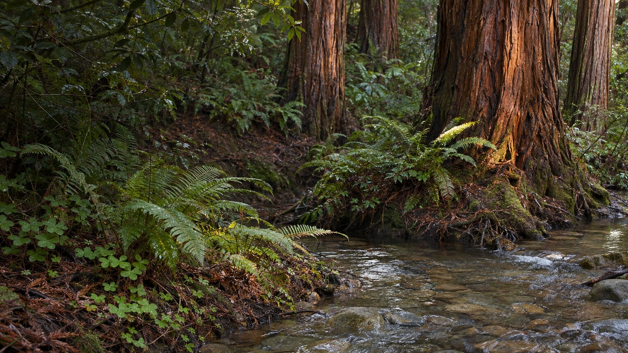
Muir Woods had more than 800,000 visitors in 2023, and anyone who drives in needs a parking reservation every day of the year. If you live in Mill Valley, you can walk there from Old Mill Park or from the bus stop at Mountain Home Inn, and late fall is a good time to do it for reasons beyond the parking lot. Redwood Creek runs through the middle of the monument. In 2023 the National Park Service rebuilt a stretch of it for young salmon. In winter the Dipsea's footbridge over the creek closes for coho spawning, and the four pedestrian bridges you cross on the main trail are on a 2026 to 2030 replacement schedule.
Old Mill Park to Muir Woods Road
The Dipsea Trail starts at Old Mill Park in downtown Mill Valley. From there the route climbs the Dipsea Steps and heads west toward Muir Woods. On the Dipsea Race course, runners cross Muir Woods Road and enter the woods a little past the two-mile marker. That puts the monument within a morning walk of Throckmorton Avenue. The full trail continues about 7.5 miles to Stinson Beach, and One Tam rates the whole route very strenuous. You only need the first stretch.
The Park Service's own directions show the way in from that side. One of its suggested loops uses the Canopy View, Redwood and Sun trails. Where the Sun Trail meets the Dipsea, walkers turn onto the Dipsea, cross Muir Woods Road and follow the roadside trail to the entrance. Coming from town, you reach the monument on the Mill Valley side of the road. You don't need the creek crossing to get in.
The footbridge that closes for coho
The Redwood Creek footbridge on the Dipsea closes every winter for coho salmon spawning season. The Park Service says to check bridge conditions at the Visitor Center. The closure matters for loops that come back over the creek from the Deer Park side. The best known of these climbs the Ben Johnson Trail from Bridge 4 and returns on the Dipsea through grassland with views of Mt. Tamalpais, the Pacific and San Francisco. In summer that loop is 4 miles with 925 feet of climbing. In winter it is 5 miles, because walkers leave the Dipsea for the Deer Park Fire Road and then turn left onto the main road back to the Visitor Center. The detour adds 0.75 mile to the hike. The Bootjack, TCC and Stapelveldt loop gets the same winter detour if you come back on the Dipsea, which takes it from 6 miles to 7.
The steep part of that climb has had recent work. SFGATE reported that the refurbished Ben Johnson Trail had reopened by July 2025. The segment it covered runs 0.2 mile between the Stapelveldt Trail and the Deer Park Fire Road.
What the creek above Bridge 3 is for
On the flat main trail, the Bridge 2 loop is half a mile, the Bridge 3 loop is a mile and the Bridge 4 loop is two miles. All three follow Redwood Creek on paved and boardwalked paths that work for strollers and wheelchairs. Upstream of Bridge 3, the creek looks different from the version many longtime locals remember. Under the Redwood Creek Salmon Habitat Enhancement Project, crews took out part of the riprap, the rock walls that had hardened the banks, and placed fallen trees from the forest floor in the channel to make fish habitat. The Park Service expects the creek itself to keep reshaping that stretch over time.
That work was finished in 2023 and was meant to give juvenile coho and steelhead shelter during winter high water. Winter is when storms scour the gravel nests and can flush newly hatched fry out of the creek. In April 2025, Park Service fish crews doing snorkel surveys reported fry using the new habitat features.
The fish counts show why that stretch matters. In the 2024 to 2025 spawning season, surveyors confirmed more than 30 coho redds, or nests, in Redwood Creek. The Park Service called that total relatively low despite hatchery releases and habitat work. Steelhead appeared that January, and one mid-January survey counted 14 live adults. The following summer, the 2025 snorkel surveys estimated nearly 6,000 young coho in the creek, the second-highest estimate in the monitoring record. The Park Service said some of those tagged fish could come back to spawn in winter 2027. That figure counts young fish, not adults coming back.
The Park Service asks visitors to stay on designated paths at all times, even for a photo. On the creek, that means watching from the boardwalk and the bridges.
Coming down from Mountain Home Inn
The other way in starts higher up. Marin Transit Routes 61 and 61F stop at Panoramic Highway and Edgewood Avenue, next to Mountain Home Inn. The Park Service puts that stop about 1.5 miles from the monument and 800 feet above it, so the round trip is a 3-mile walk with 800 feet of descent and climb.
The Golden Gate National Parks Conservancy notes that the Panoramic Trail connects to the Canopy View Trail and other routes that drop into the valley. In the Park Service's directions from the bottom, Canopy View climbs about 1.5 miles from the main trail to the Panoramic Trail. Walking down from the inn, you take that same stretch in reverse. For a full loop, the Park Service's 5-mile circuit with 780 feet of gain links Canopy View, the Redwood Trail and the Sun Trail. On the way it passes the Tourist Club, which is open to members only, then rejoins the Dipsea and crosses Muir Woods Road back to the entrance.
Fern Creek is the gentler option from the valley floor. Its trailhead is a quarter mile past Cathedral Grove, and the 3-mile loop climbs 340 feet to Camp Alice Eastwood, which has water, restrooms and picnic tables.
What it costs and when it's open
The Park Service fee page lists the standard entrance pass at $15 and the Muir Woods annual pass at $45.
If someone in your group drives, a parking reservation on GoMuirWoods is $10 for a standard vehicle. The shuttle is $4 per adult round trip but generally runs only on summer weekends and holidays. Reservations come with a 30-minute arrival window. Download yours before you leave, because there is no reliable cell service at the monument. The same goes for a rideshare home: the Visitor Center has limited Wi-Fi and a pay phone. Winter hours are 8 a.m. to 5 p.m. daily, and the monument can close in hazardous weather.
Several of the upper trails are in Mt. Tamalpais State Park. The Park Service suggests checking State Parks alerts for closures before you set out. State Parks started grinding and paving Pantoll Road on November 2, with weekday one-way traffic control for up to three weeks. That matters if you plan to start higher on the mountain.
The bridges on the replacement list
The Park Service groups its work at the monument under the name Redwood Renewal, and its project page was updated on October 13. The salmon habitat work is complete. The next phase is replacing four aging pedestrian bridges across Redwood Creek between 2026 and 2030, both to keep accessible crossings and to help the stream channel. A new Dipsea Trail pedestrian bridge is scheduled for construction in 2027 and 2028, after a design phase running through 2026. A larger redesign of the parking areas, trails and entrance boardwalk is planned for construction from 2028 to 2033.
The road changes too. On October 20, 2026, the Marin County Board of Supervisors approved the Muir Woods Road Improvement Project along with its environmental review. The county filed the Notice of Determination on October 26. The project covers the road between Highway 1 and the monument. It will replace the Muir Woods Road Bridge over Redwood Creek, repave the road and upgrade drainage to cut stormwater pollution. The Park Service says near-term impacts on visitors and residents are inevitable while this work goes on.
Through 2030, then, the main trail's bridges and the Dipsea crossing will be rebuilt. This winter's walk uses the bridges as they stand now and passes the creek stretch above Bridge 3 in its fourth winter since the restoration.
I'm Paul O'Neil, and if you're thinking about a home in Mill Valley, I'm happy to talk through which streets put the Dipsea Steps or the 61 stop in easy walking distance and what that daily access is like. Paul O'Neil is glad to compare notes over coffee downtown. Let's Connect.